This map will change how you think about immigration in Britain
This map will change how you think about immigration in Britain
When you think about immigration in the UK, the countries that spring to mind aren't France, Germany, Scotland and Ireland.
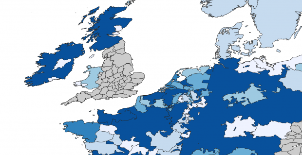
This map, made by englandsimmigrants.com, shows the number of immigrants moving to England from from 1330-1550.
The information comes from a variety of historical sources including taxation assessments, letters of denization and protection, and a variety of other licences and grants during a politically turbulent time in Europe.
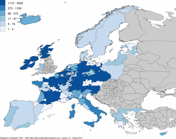
The areas in dark blue, such as Ireland, Scotland, France, and Germany show areas where the most people emigrated to the England.
Immigrants to the UK, 1330-1550
Resident Aliens in the Late Middle Ages
French
Scot
Norman
'Dutch'
Irish
Teutonic
Fleming
Hollander
Brabanter
Breton
Italian
Genoese
Zeelander
German
Picard
Venetian
Florentine
Icelander
Gelderlander
Gascon
Liégeois
Clevelander
Utrechter
Lucchese
Channel Islander
Lombard
Welsh
Greek
Westphalian
'Easterling'
Portuguese
Spaniard
Hainauter
Orcadian
Prussian
Frisian
Saxon
Artesian
Milanese
Danish
Aragonese
Roman
Ferrarese
Burgundian
Swabian
Savoyard
Pole
Lorrainer
Swedish
Norwegian
Castilian
Piedmontese
Manx
Alsatian
Navarrese 3
Limburger 3
Catalan 3
Austrian 3
'Indian' 3
Pomeranian 2
Bavarian 2
Basque 1
Armagnac 1
'Northern man' 1


Comments
Post a Comment